Data model
All records of a resource are held together by a single MapResource which
holds the main classes Feature, Tag, and Tile. The core class
Feature can hold GeoJSON information to describe various geometries such as
points, line strings, polygons, multi points, multi line strings, multi
polygons, or geometry collections.
Each MapResource may specify a number of Tile objects it wants to map
its data onto. The data model itself does not check whether the tiles are
available and whether you are allowed to use them. Some providers limit the
number of requests per day or month, for example. In addition, please note that
the tiles added here may require you to add a notice to your website's privacy
policy about requests being made to external servers.
Coordinates and Distribution classes are available for other data
models to easily describe exact locations and geographic token distributions,
respectively.
In addition, the model knows flexible LabelTag and SameAs classes,
which can be used to group features via labels and to connect entities to
authority files.
Graphical overview
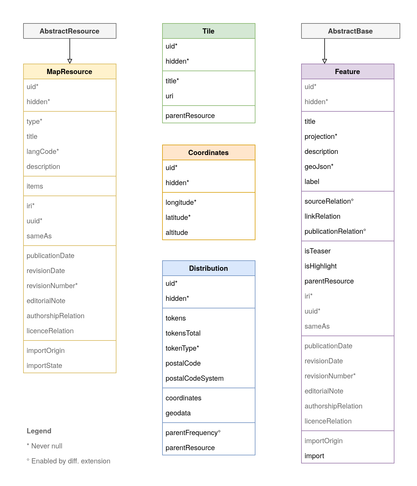
Overview of the extension's data model. Check the API reference for further details.